Overview
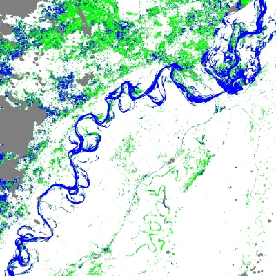
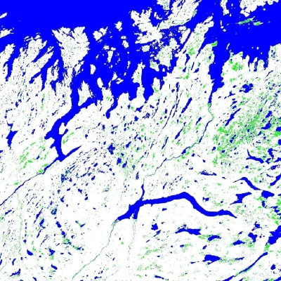
The Dynamic Surface Water eXtent (DSWx) product suite maps the presence and extent of inland and near-shore surface water using optical and synthetic aperture radar (SAR) observations. DSWx supports OPERA’s surface-water mission objective, providing frequent, analysis-ready water maps for hydrology, flood response, and long-term water-resource monitoring.
Product level & distribution
Processing level: Level-3
DAAC: PO.DAAC
Project: NASA OPERA (JPL)
Sub-products
DSWx-HLS — derived from the Harmonized Landsat Sentinel-2 (HLS) dataset.
DSWx-S1 — derived from Sentinel-1 C-band SAR, enabling water mapping under cloud cover and at night.
Applications
Inland surface-water mapping and change detection
Flood monitoring and disaster response
Seasonal and inter-annual water-body dynamics
Inputs for hydrologic and climate studies
Inputs
Harmonized Landsat Sentinel-2 (HLS) surface reflectance (DSWx-HLS)
Sentinel-1 SAR backscatter, e.g. OPERA RTC-S1 (DSWx-S1)
Digital elevation model and ancillary water-reference layers
Coverage
Near-global land coverage, with cadence driven by the revisit of the underlying HLS and Sentinel-1 observations.
References
OPERA project page: https://
www .jpl .nasa .gov /go /opera PO.DAAC: https://
podaac .jpl .nasa .gov DSWx-HLS at PO.DAAC: https://
podaac .jpl .nasa .gov /dataset /OPERA _L3 _DSWX -HLS _V1 DSWx-S1 at PO.DAAC: https://
podaac .jpl .nasa .gov /dataset /OPERA _L3 _DSWX -S1 _V1